Covering an incredible 20,105 square miles, San Bernardino County holds the distinction of being the largest county by land area in the contiguous United States. To put its sheer vastness into perspective, this single Southern California region is larger than the states of New Jersey, Connecticut, Delaware, and Rhode Island combined. Yet beyond its impressive cartographic boundaries lies a territory of breathtaking geographic diversity and rich historical layers, stretching from lush citrus-lined valleys and pine-covered alpine ridges to sprawling desert basins.
Understanding the Four Distinct Geographic Regions
Navigating San Bernardino County requires understanding its four primary geographical zones. Each region possesses its own distinct topography, microclimate, economic heritage, and cultural identity.
1. The San Bernardino Valley
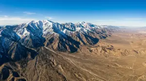
Nestled along the southwestern corner of the county, the San Bernardino Valley serves as the urban heart of the region. Frame by the San Gabriel and San Bernardino Mountain ranges, this fertile valley historically nourished Indigenous communities along the Santa Ana River before becoming a center for Spanish ranchos, 19th-century citrus groves, and modern transportation logistics. Major cities including San Bernardino, Redlands, Ontario, Fontana, and Rancho Cucamonga define this populous corridor.
2. The Mountain Communities (San Bernardino Mountains)
Rising dramatically above the valley floor, the alpine landscape of the San Bernardino National Forest offers a stark contrast to the Mediterranean climate below. Peaks like Mount San Gorgonio reach heights of 11,503 feet—the highest point in Southern California. Communities such as Lake Arrowhead, Crestline, Running Springs, and Big Bear Lake have long served as premier mountain destinations for four-season outdoor recreation, timber harvesting, and winter sports.
3. The Victor Valley & High Desert
Positioned directly north of Cajon Pass, the High Desert region lies within the Mojave Desert ecosystem at elevations typically ranging between 2,500 and 3,500 feet. Centered around population hubs like Victorville, Hesperia, Apple Valley, and Barstow, the Victor Valley transitioned from early 20th-century poultry and alfalfa farming into a thriving suburban region while serving as a vital crossroads for rail and highway transportation.
4. The Mojave Expanse & Low Desert
Encompassing the vast eastern half of the county, the Mojave Expanse is a realm of wide horizons, volcanic craters, rugged mountain ranges, and historic desert highways. Home to Morongo Basin communities like Twentynine Palms and Yucca Valley, as well as the protected wilderness of Joshua Tree National Park and Mojave National Preserve, this region preserves the quiet grandeur of the American West.
San Bernardino County Geographic Profile:
- Total Land Area: 20,105 square miles (52,072 sq km)
- Highest Elevation: San Gorgonio Mountain — 11,503 ft (3,506 m)
- Lowest Elevation: Danby Dry Lake — 430 ft (131 m)
- Primary Mountain Passes: Cajon Pass (I-15 / US 66) & San Gorgonio Pass (I-10)
Historical Eras That Shaped the Regional Landscape
The physical geographic features of San Bernardino County directly directed human settlement and trade patterns for centuries. Tracing the historical archives reveals how each era left an indelible mark on the county grid.
For millennia prior to European contact, Native peoples including the Serrano, Cahuilla, Chemehuevi, and Mojave tribes established intricate trade networks across desert trails and mountain passes, relying on natural springs and seasonal mountain resources.
During the early 19th century, Spanish missionaries established outposts like the San Bernardino Asistencia along the Santa Ana River watershed, laying the groundwork for the Rancho era. By 1851, Mormon pioneers established a planned city grid in the valley, establishing agricultural colonies and timber operations in the nearby mountains.
The late 19th century transformed the region into an economic powerhouse. The introduction of the Washington Navel Orange led to the famous “Citrus Belt” boom in Redlands and Highlands, while transcontinental railroads engineered routes through Cajon Pass, permanently establishing San Bernardino County as Southern California’s premier supply chain and travel corridor.
Preserving Archives and Regional Identity

Because the county spans such vast distances, regional preservation efforts rely on a network of dedicated institutions. The San Bernardino County Museum system in Redlands maintains extensive archives covering regional paleontology, Indigenous basketry, Citrus Era artifacts, and pioneer history.
Complementing county-wide institutions are specialized local archives, such as the Mojave Desert Heritage and Cultural Association at Goffs, the San Bernardino History and Railroad Museum, and local historical societies in Big Bear, Victorville, and Twentynine Palms. Together, these archives preserve the letters, maps, land deeds, and photographs that document the transformation of California’s largest county.
Tips for Exploring San Bernardino County Archives & Regions
Whether you are a researcher delving into historical land records or a traveler setting out to experience the geographical diversity of the county, keep these practical tips in mind:
- Plan for Microclimates: Weather conditions vary dramatically. It is entirely possible to experience snow in Big Bear while enjoying 80-degree weather in the valley on the exact same day.
- Utilize Regional Hubs: Structure self-guided regional tours around logical transit hubs—Redlands/San Bernardino for valley history, Victorville/Barstow for desert corridors, and Lake Arrowhead/Big Bear for mountain archives.
- Check Museum Archive Hours: Many specialized archival collections operate on limited public research hours or require advance appointments for document review.
From the peak of San Gorgonio to the vintage asphalt of Route 66 in Amboy, San Bernardino County’s unique blend of geography and history continues to define the landscape of Southern California.